
NEO’s SignalEyes Infrastructure is ready to roll


SignalEyes is a high-quality change detection services infrastructure from EO data developed by ‘SIG4EO’, the brainchild of Dutch company NEO (Netherlands Geomatics and Earth Observation).
On April 2, 2020 it has officially become the first InCubed activity to be concluded.
During its final review, NEO has presented all the work accomplished under the ESA InCubed contract, but also its future perspectives.
The team proudly announced that their infrastructure is now arrived at a level where the activity starts for the entire Netherlands territory. With five national Open Data coverages of Superview 50cm imagery per year, other Open Satellite Images and Open Aerial Photographs, the monitoring of all crop parcels on geometry and crop development has started.
Started in March 2019, this InCubed activity’s purpose was to automatically assimilate different Earth observation data streams together with Object Based Signal Generators (OBSG) using cutting edge technological techniques such as deep learning or other artificial intelligence.
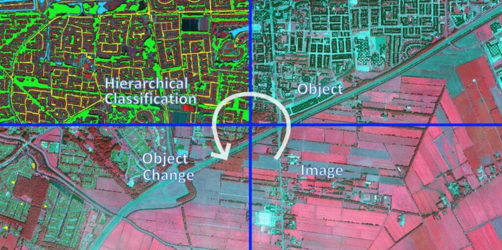
After having built up a library of OBSGs for different types of objects and image types –– , NEO aimed at placing and combining these OBSGs in the processing chain in optimised way, linking image changes and neighbouring objects together, to provide relevant and true change signals, mitigating false positives, offering improved control over the processing and establishing an operational service with more robust and better quality results.
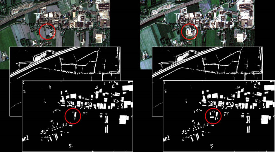
For example, the figure above shows two layers extracted from satellite imagery (top) : roads (middle) and buildings (bottom). Each layer shows different kinds of information, taken at different times. Comparing the left and right images, it can be seen that there are additional buildings on the right set of images.
Now that the activity is concluded, it is possible to monitor the 150 million trees already present in the NEO database and start adding water courses, roads, railroads, buildings and other terrain elements as well as smaller elements as solar panels, asbestos roofs, riparian vegetation, etc.
The changes registered will be translated into Calls-to-Action for customers in agribusiness, management of infrastructure and environment and map updating, increasing the efficiency but also reducing cost, spills and frustration for professionals working in these areas.
As NEO Chief Operating Officer Jan Erik Wien stated “SIG4EO enables us to scale up our own operations in volume, number, diversity and geographic spread and creates competitive advantage in providing change information services over the next ten years. The ESA InCubed program, has allowed us to speed up these challenging but high potential developments and maintain our international leading position in the field of remote sensing based change detection.”
To know more about it:
Activity page