
 Data Processing & Visualisation
  Data Analytics, Insights & Applications
  Platform
 The proposed solution consists of a cloud-based platform to assess and forecast pluvial, fluvial and coastal hazard and support communities with high resolution, timely and accurate flood risk intelligence. The cloud platform provides a digital copy, so called ‘twin’ of the urban catchment, where users can quickly and cost-effectively generate flood hazards and risk maps, allowing the test of the effectiveness of multiple flood mitigation measures, and supporting early warning and flood emergencies.
With the integration of Earth Observation satellite data, the SaferPlaces platform can automatically generate more accurate inputs to the existing algorithms, in terms of flooded areas, rainfall data and DEM generation. By performing calculations in almost real time, with the ability to include climate risks and adaptation plans, SaferPlaces supports multiple stakeholders in improving preparedness and climate resilience.
Multiple stakeholders, public and private, are involved when flood events happen. They can benefit from punctual, location-explicit and timely information provided by the SaferPlaces platform to understand, respond and plan appropriately against flooding. Specifically, SaferPlaces can help:
The common main challenges faced by all the stakeholders is the uneven coverage of flood data and risk maps at global level, as well as the lack of in-house tools and expertise to deal with flooding.
Europe, US, Worldwide
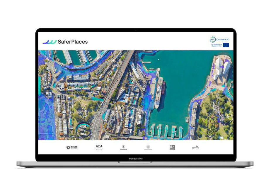
The SaferPlaces platform already delivers on-demand timely risk assessment data for pluvial, fluvial and coastal flood hazards, by creating a digital twin of any urban flood watershed environment.
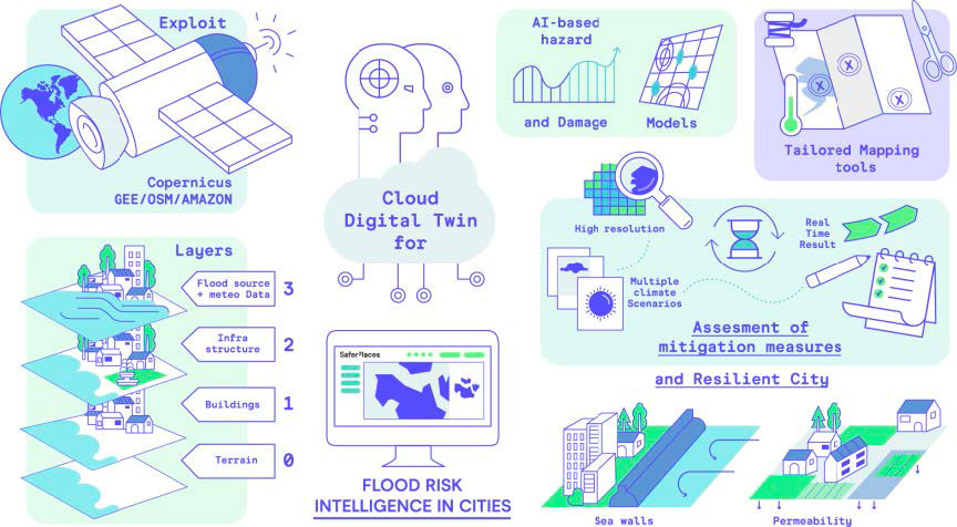
The innovation consists in integrating within a cloud computing framework the availability of big open data (climate, satellite, economic exposure and elevation model) repository (Copernicus (Sentinel), Capella Space, ICEYE, COSMO, UP42 Airbus, Google Earth Engine and Amazon) and innovative AI-based flood hazard and damage models with proprietary IPR. The users can generate the required flood risk intelligence with global coverage through a few easy steps and with competitive economic costs.
Within the framework of ESA Incubed, we are developing new functionalities able to integrate satellite data and automatically generate three fundamental spatial layers:
These layers are merged within the elastic and scalable cloud framework of the SaferPlaces platform, with the aim to ensure global high-resolution coverage and provide more accurate input data to the existing model component algorithms. In addition, they enrich the platform with the possibility to map in quasi-real time flood hazards, for supporting flood emergency and disaster management.
SaferPlaces differs from other products already existing because it offers not only static maps, but a cloud web platform performing calculations in almost real time, with the ability to include climate risks and adaptation plans. In addition, it exploits high-resolution data, fills data gaps when present, and addresses multiple climate and mitigation scenarios.
One of SaferPlaces unique characteristics is accessibility: high-resolution flood risk maps with no need of complex and resource-intensive models. Nevertheless, compared to existing solutions SaferPlaces has other unique advantages: first of all, it allows global coverage, solving the needs of those investing and operating in remote locations; second, SaferPlaces is cost-effective, requiring no computing power or significant pre-existing expertise. Last but not least, SaferPlaces provides climate and resilience-related insights: it offers the customers the chance to see whether flood risk mitigation options work under dynamic urban and climate conditions.
SaferPlaces is proud to announce the successful completion of the 18-month ESA InCubed Project, culminating in an enhanced Global Platform, supporting users worldwide in assessing flood risk and making data-driven, flood-smart decisions. By integrating Earth Observation (EO) and climate data with AI-based models, SaferPlaces provides invaluable insights into flood risk.
Innovations and Integrations
During the ESA InCubed Project, significant research efforts focused on integrating Earth Observation satellite data to enhance input layers such as flooded areas, terrain information (Digital Elevation Models – DEM), and rainfall data. This integration has led to the development of three EO-based modules:
These advancements were validated with flood events that happened in the pilot areas of Vietnam, Cesenatico, and in the Emilia-Romagna region, Italy, during the severe flood event in May 2023. The platform demonstrated its effectiveness in generating accurate flood risk assessments and the possibilities for enhancing disaster response capabilities.
The Future in Flood Risk Intelligence
The SaferPlaces platform represents a significant leap forward in flood risk management, offering a robust tool for cities and communities to better prepare for and respond to flood events. The integration of advanced EO data ensures that the platform provides precise, actionable intelligence, enabling stakeholders to make informed decisions that enhance climate resilience, protect people and assets.


 email
email  Facebook
  Twitter
  Linkedin
  Whatsapp
  Copy link