
 Platform
  Payload
  Ground Networks & Data Distributions
  Ground Stations & Mission Management
  Data Processing & Visualisation
  Data Analytics, Insights & Applications
 Wildfires represent a growing global risk, driven by climate change and increasing in both frequency and intensity. They generate substantial CO₂ emissions, cause significant economic losses and impact critical sectors such as forestry, infrastructure, and carbon markets. Effective mitigation depends on timely detection, continuous monitoring and actionable intelligence.
Existing wildfire detection approaches, both ground-based and satellite-based, face limitations in scalability, latency and temporal coverage. In particular, current satellite systems exhibit a critical ‘afternoon gap’, a time window during which wildfire ignition and spread are most likely to occur but observation coverage remains limited.
To address these challenges, OroraTech has developed the Wildfire Solution (WFS), a scalable intelligence platform that integrates data from more than 25 satellite missions, combined with proprietary analytics and additional datasets such as weather and lightning information. The system supports the full wildfire lifecycle, including risk assessment, early detection, monitoring and post-fire analysis.
The objective of this activity is to further enhance this capability through the development and validation of proprietary satellite infrastructure. The FOREST-3 mission represents a key step in this evolution, enabling the acquisition of dedicated thermal-infrared data and reducing dependency on third-party sources.
By contributing to the development of a Minimum Viable Constellation (MVC), the activity increases revisit frequency, reduces detection latency, and improves temporal coverage, particularly during critical periods. This integrated space-and-service approach enables near-continuous monitoring and significantly enhances the operational value delivered to customers.
The key customer segments targeted by OroraTech’s Wildfire Solution are in both the B2G (public) and B2B (private) sectors. Governments, fire services, commercial forestry companies, infrastructure and energy providers, insurance companies and environmental organisations represent the primary users of the system.
In the B2G segment, the solution supports operational needs related to early wildfire detection, real-time monitoring, and situational awareness, enabling efficient response and resource allocation. In the B2B segment, commercial forestry operators, infrastructure providers and insurers require reliable and timely data to protect assets, manage risk and support decision-making processes.
Across all segments, customer needs increasingly go beyond simple detection and include continuous monitoring, fire spread prediction, impact assessment, and integration into operational workflows.
The system is developed following a customer-centric approach, with key users actively involved in validation activities. Organisations such as SOPFEU (Canada) and the National Parks and Wildlife Service (Australia), together with other international stakeholders, provide operational feedback to ensure alignment with real-world requirements.
Wildfires are a global phenomenon affecting all continents. OroraTech’s Wildfire Solution is designed as a fully scalable global service, supporting customers across more than 25 countries and monitoring hundreds of millions of hectares worldwide.
OroraTech provides a vertically integrated Wildfire Intelligence-as-a-Service (IaaS) solution, combining its Wildfire Solution platform with proprietary thermal-infrared satellite data. By integrating multi-source satellite data with its own constellation, including the FOREST-3 mission, the system significantly improves detection latency and temporal coverage, particularly during critical periods such as the afternoon gap. This results in faster and more reliable wildfire detection and monitoring, while demonstrating the viability of combining proprietary nanosatellite data with existing sources to deliver a scalable, low-latency global service.
OroraTech’s solution differentiates itself through a fully integrated, end-to-end approach combining proprietary space-based data with advanced analytics and a customer-focused service. The Wildfire Solution aggregates a large number of satellite data sources on a global scale, complemented by proprietary thermal-infrared data, resulting in reduced detection latency and enhanced monitoring capabilities.
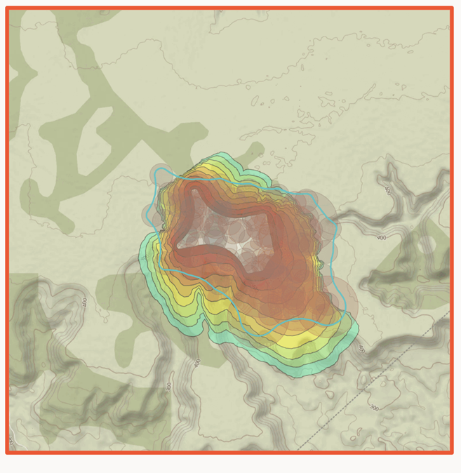
Fast alerts and updates are automatically delivered to users for their areas of interest, enabling efficient deployment of fire suppression resources. Advanced features such as hotspot fusion across multiple data sources, fire spread modelling and the integration of environmental data layers (e.g., weather and wind) provide comprehensive situational awareness. In addition, the system incorporates non-space data sources, such as ground-based sensors and cameras, further enhancing detection accuracy and operational value.
From a technical perspective, the proprietary payload is based on a miniaturised multispectral thermal-infrared imager, optimised for CubeSat platforms and capable of sensing both mid-wave and long-wave infrared radiation. This enables reliable detection of high-temperature events such as wildfires. To further reduce latency, onboard GPU-based processing allows for in-orbit detection, while optimised communication architectures support rapid data delivery.
Compared to non-space-based solutions, the system provides significantly higher scalability and cost-efficient coverage of large geographic areas, ranging from regional to global scale. Continuous customer feedback and validation ensure that the solution remains aligned with operational needs and evolving market requirements.
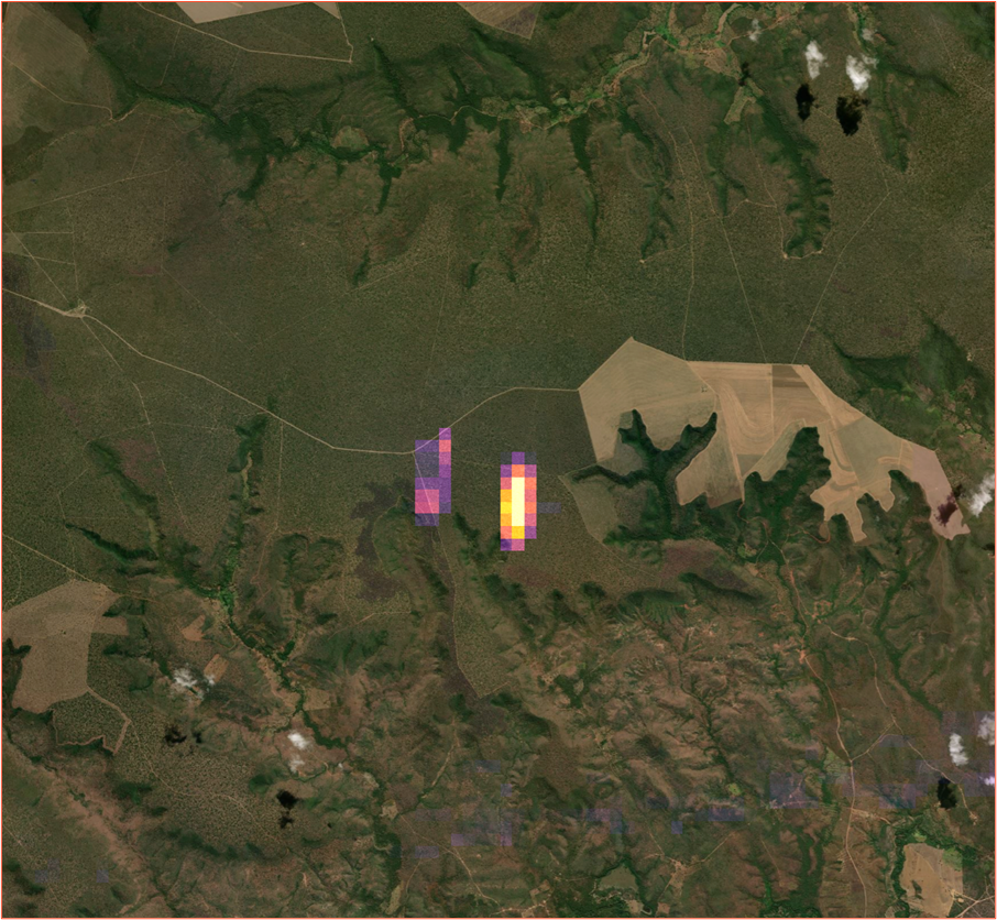
OroraTech has successfully demonstrated a fully integrated wildfire intelligence system combining space, ground and user segments. The FOREST-3 mission represents a major milestone as the company’s first fully in-house developed end-to-end satellite system. The satellite has been successfully launched, commissioned and validated in orbit, demonstrating robust platform performance and operational wildfire detection capabilities.
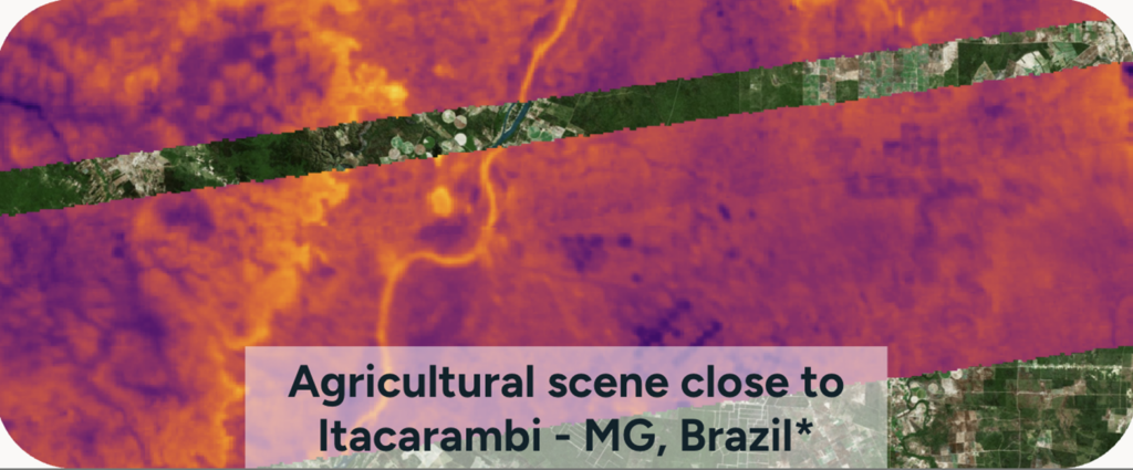
Validation activities have confirmed the stable operation of core subsystems, including power, thermal, communications, and attitude control, as well as the successful acquisition of thermal-infrared imagery in both mid-wave and long-wave infrared bands.
The mission further demonstrates the flexibility and robustness of OroraTech’s system architecture, where optimised data processing pipelines and communication strategies ensure reliable and timely delivery of wildfire information to end users. From a service perspective, FOREST-3 operates as an integrated data source within the Wildfire Solution, supporting near-real-time wildfire detection and continuous monitoring capabilities.
Commercially, the system has demonstrated strong market traction, with a growing global user base, large-scale monitored areas and multiple high-value contracts across government, forestry and insurance sectors. Overall, the activity confirms both the technical feasibility and commercial viability of OroraTech’s vertically integrated wildfire intelligence service and establishes a solid foundation for scaling the satellite constellation and expanding global service coverage.

 email
email  Facebook
  Twitter
  Linkedin
  Whatsapp
  Copy link