

 Data Analytics, Insights & Applications
 Information on ground motions is particularly important for the monitoring and management of pipelines and buildings (plus other human-made infrastructures like roads, railroads, tunnels, bridges, metro).
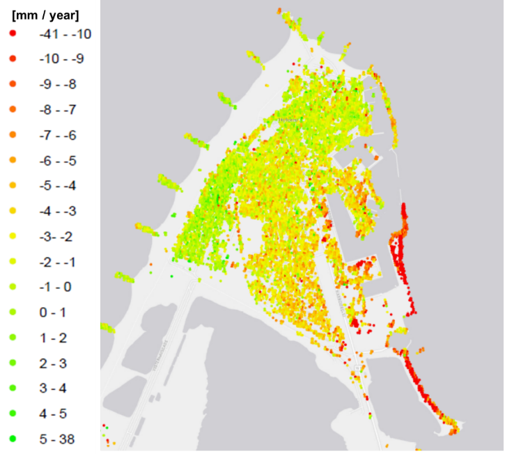
In the first InSARinSub project, new methods for Sentinel radar imagery were developed and utilised for mapping ground motions. This can replace very time-consuming manual surveying.
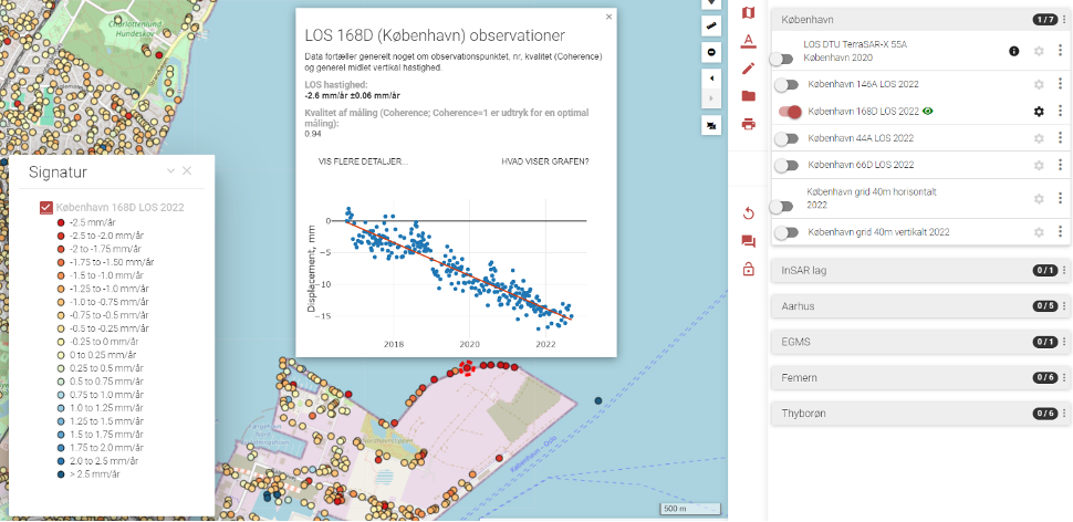
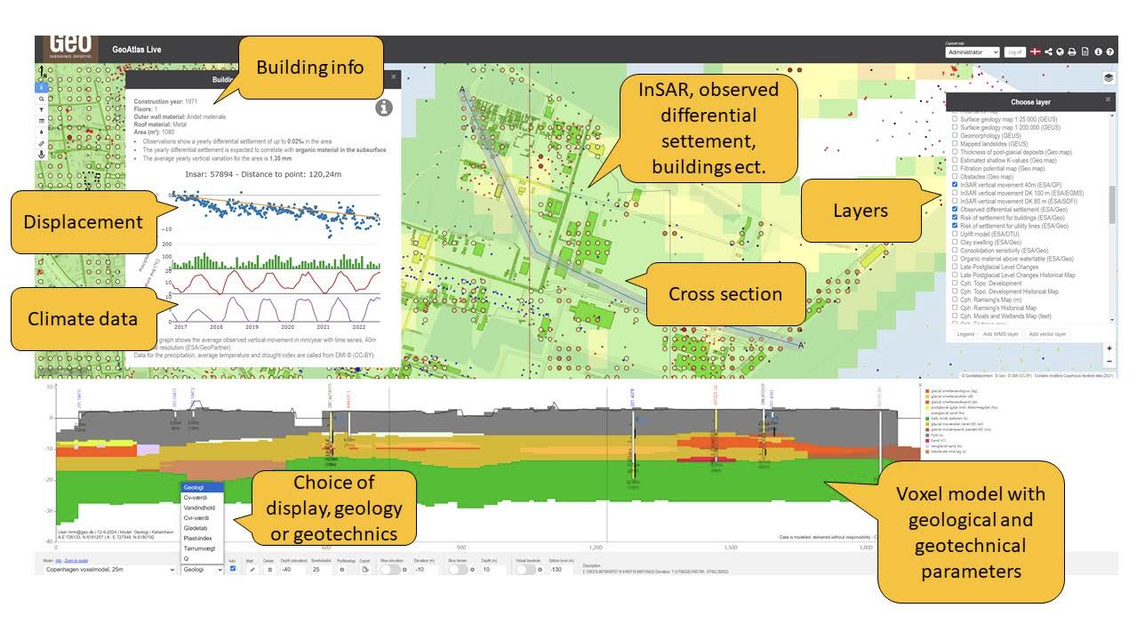
The satellite-derived ground motion information/mapping was coupled with geological and geotechnical modelling, and hereafter visualised in two GIS web-portals for selected end-users.
In the CCN part of the contract, areas of interest were expanded significantly, and the geological voxel modelling was upgraded even further to include more geophysical and geotechnical parameters.
Also, new end users were included in a more interactive manner, through a continuous dialogue and bilateral meetings, in order to develop useful prototypes and functionalities in GeoAtlas Live.
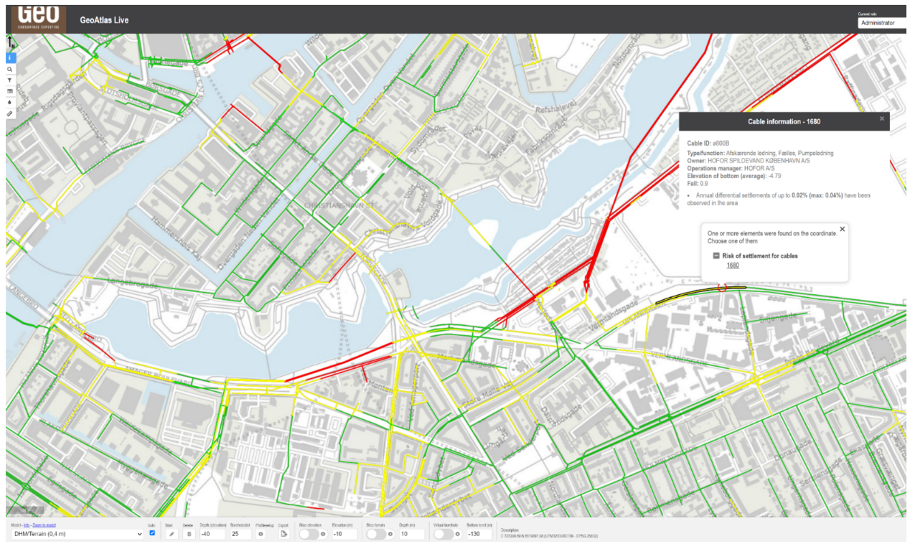
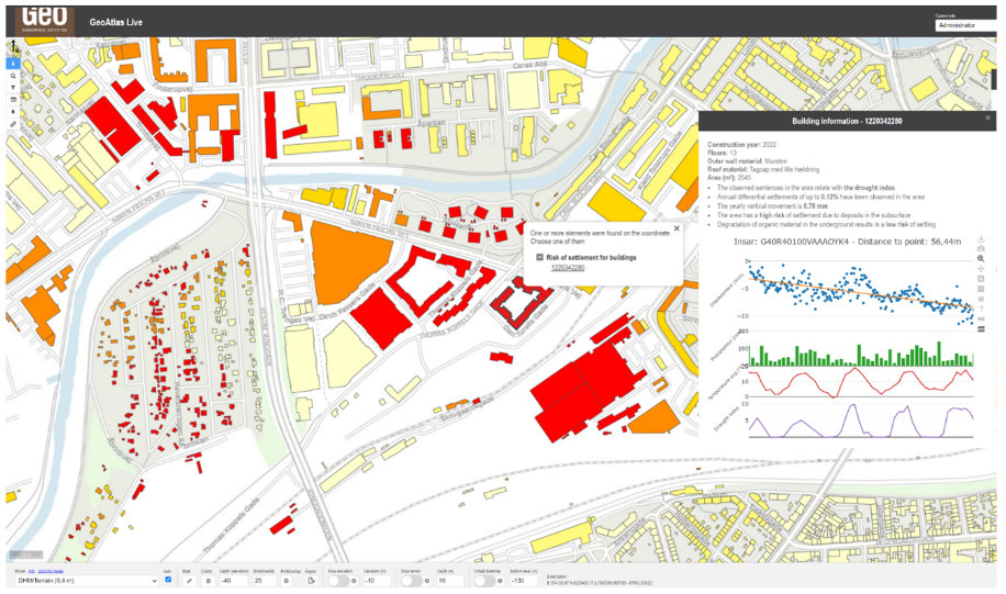
Our end products are operationally available in GeoAtlas Live, and directly useful to a number of clients within the utility and engineering sectors, or administrative management for governmental/municipal monitoring.
Our end users have the possibility to integrate our products directly into their own systems with API services from Geo and Geopartner.
Key end-user segments including local utility companies, municipal and national authorities have participated in this activity to ensure that product functionality and operationalisation provides optimal value. For instance, in the utility sector there is a constant push for better climate change adaption and better asset management of existing pipeline systems.
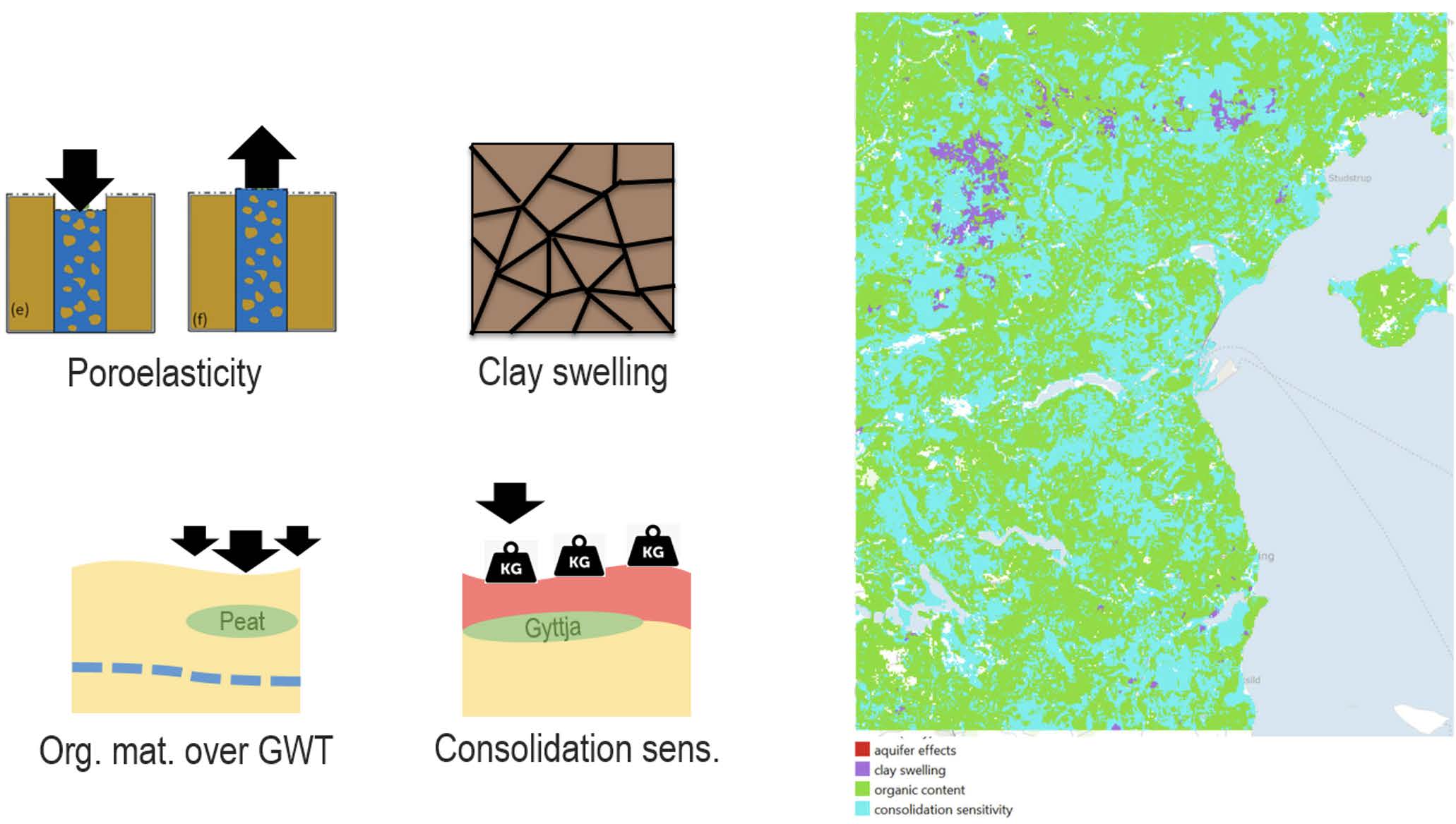
Ground deformation affects underground infrastructure in different ways and is of significant interest for utility companies. Instances where ground deformation patterns vary over short distances, water and/or gas pipelines may succumb to the stress and break, while other ground deformation patterns may cause a decrease of the slope of the pipelines leading to malfunctioning of the wastewater systems, among other issues.
A detailed subsurface model can help provide answers to how and why the ground motion occurs, and this can also be used to estimate ground movement, even in areas with poor satellite data coverage. To the utility sector, this directly results in a faster and more robust, agile, and cost-efficient renovation of pipelines.
Road authorities, rail-road authorities, and other authorities at municipal or governmental levels have interest in monitoring existing buildings and existing above-ground infrastructures. Subsidence risk mapping is also equally valid for planning new built-up urban areas, or new infrastructures like roads or bridges.
Denmark, Sweden, Germany, Netherlands.
The developed products include:
• Ground-motion products and functionalities made available for the end users within two specialised web-based tools called GeoAtlas Live and MapGM. The products are targeting utility companies, engineering companies, and authorities of various types as described above.
• The products are disseminated directly through the two platforms, and can also be made available through APIs directly into our users existing GIS systems.
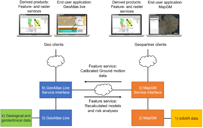
The InSAR-based calibrated ground-motion products and modelled subsurface/risk analyses are exchanged between the MapGM and GeoAtlas Live platforms.
This synergetic use of ground-motion information and geological data (and modelling) is novel. It also strengthens the models and derived risk products, returning added-value, ground-motion products.
Before InSAR data became readily available, ground-motion maps could not be easily produced with this level of detail or spatial coverage. The recent availability of the Sentinel-based EGMS services (Pan-European) has also lifted the usage and potentials to new levels.
The original project contract was successfully completed in January 2022.
A CCN contract extension/addition was added and carried out from May 2022 to September 2024.
The Final Review meeting of the CCN took place on 1 October 2024.


 email
email  Facebook
  Twitter
  Linkedin
  Whatsapp
  Copy link