

 Data Processing & Visualisation
  Data Analytics, Insights & Applications
 Forestry companies need accurate and up-to-date data, which traditional forest inventory assessment cannot provide. The more detailed information about a forest is available, the more effective plans and decisions can be made, taking into account individual trees in the forest. Therefore, the goal is to develop an EO-based tree species classification methodology, and the related online service platform based on the needs of key customers in their operational environment.
Forest managers and national parks primarily require high-resolution data for accurate planning, their average area size is smaller, so we serve their needs by using high-resolution multispectral Planet data and geometric data from LiDAR data, providing them with products such as high-resolution tree species maps, individual tree-level invasive species maps and tree volume estimation.
At the same time, public actors and decision-makers require data with national coverage, where we provide data based on time-series Sentinel images for transparency, preparation of various reports, continuous monitoring of the area and identification of intervention areas.
We assessed the customers’ needs before designing the service. For the management and operational planning of the forest assets of state and private forest management companies, national park directorates and accurate knowledge of their area of operation is a prerequisite. The need for a solution that examines large areas in a short time, reduces the need for human resources and evaluates the actual condition of the entire area at the same time arose from the forestry sector.
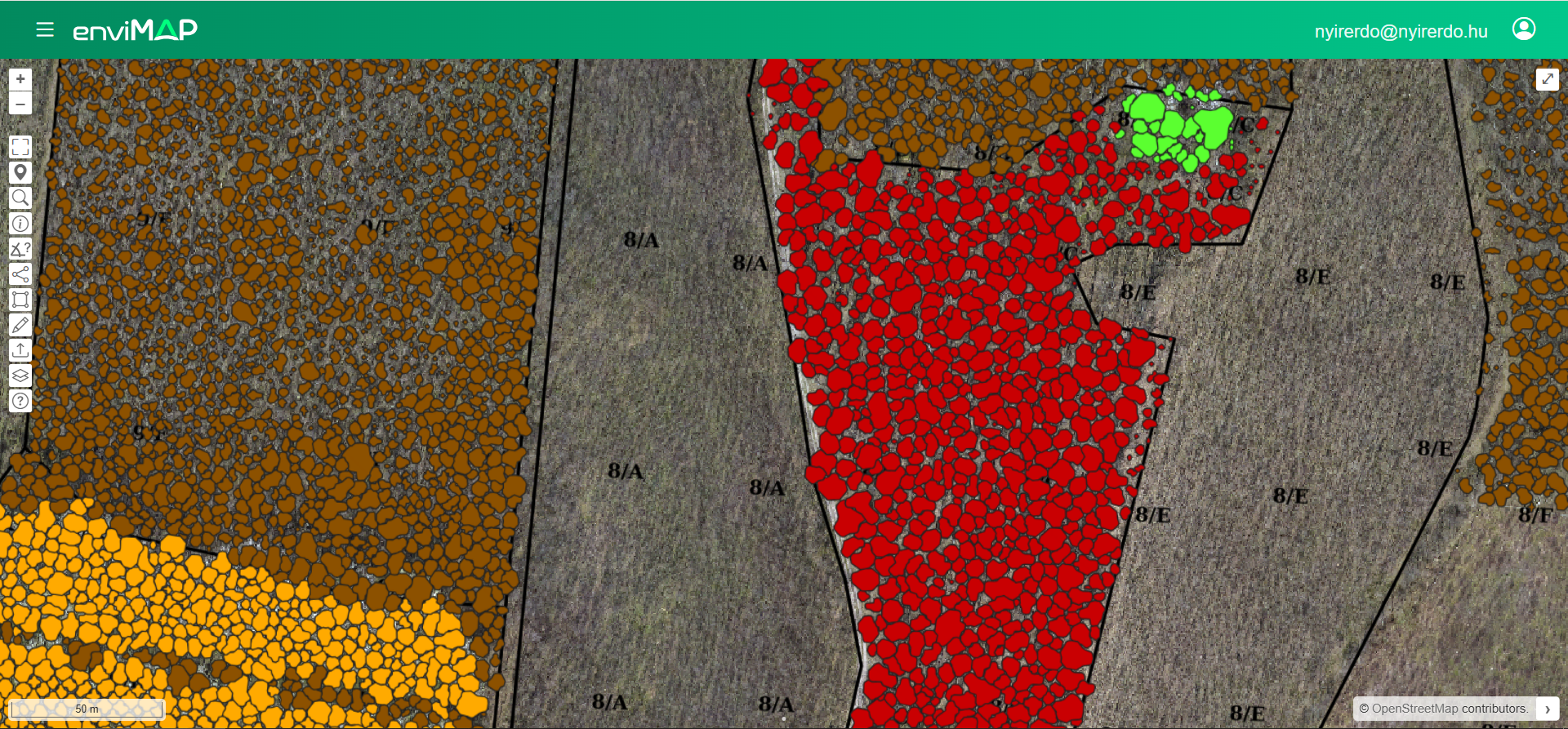
In order to implement either mechanical or chemical treatments against invasive species at the right time, accurate information, species and individual tree identification is required. For national authorities, a tool which serves data that is independent from data providers and gives the possibility to check the differences, monitor changes and control the whole forestry sector is needed. National agencies, decision makers focusing on adaptation to climate change and/or biodiversity require information and monitoring of large areas to plan mitigation activities against the negative effects of climate change (e.g. forest health decrease, spread of invasive species).
The service firstly targets the Hungarian forestry sector, but it can be extended to any countries with mixed forests, mainly focusing areas where LiDAR data is available open source.
EnviMAP Forest is an online GIS supported map service based on high-resolution multispectral Planet data, LiDAR data and Sentinel satellite imagery to support forest management activities. The online platform offers several products, such as individual tree species maps, estimated timber volume and dendrometric parameters, maps of invasive species, monthly forest monitoring and change detection, and several GIS functions to support the daily work of foresters, authorities and agencies focusing on climate change mitigation.
The online map platform enables effective dissemination of information and user-friendly interfacing with customers, without special knowledge or infrastructure needed (fat server/thin client model). Clients can check and manage their data for areas of interest, 24/7 from anywhere there is internet access.
The innovation resulting from the project ensures accurate knowledge of the operation area, showing species classification maps and estimates timber volume for the entire area. Accordingly, large areas can be examined in a short time with low human resource requirements, evaluating the actual condition of the entire area at the same time. By using our service, unit costs can be reduced to 5-10 €/ha comparing to the 28-32 €/ha price of field measurements.
Remote-sensing images also allow the simultaneous mapping of the health status of the forest. The service gives exact data about the location of invasive species, and their spread is monitored.
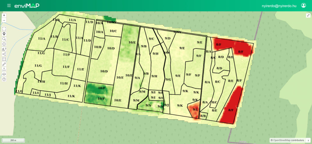
Vegetation maps and monitoring are providing information about reality, and unauthorised activities can be identified. The system generates leads to decision makers where there is a difference between the provided data and the calculated and measured data.
With the implementation of continuous monitoring, up-to-date information is available regarding the changes occurring in the forests (vegetation changes, forest growth).
The Final Review of the project took place on 03 July 2025.
All project activities have been successfully completed. The product has reached TRL 9 and is ready for commercialisation.
All work packages (WPs) were successfully finalised. Stage 1 validation with users confirmed both the product’s novelty and its suitability for the market.
Prior to setting the final pricing, a Stage 2 validation will be carried out with four end users and over larger-scale areas.


 email
email  Facebook
  Twitter
  Linkedin
  Whatsapp
  Copy link