

 Data Analytics, Insights & Applications
 Farming, land management and flood planning all depend on understanding the environment, yet keeping track of change across large areas is difficult. The data these sectors need sit in separate systems that do not interact with each other. Ground sensors are precise, but they cover only a small area. Satellites cover huge areas, but they cannot see conditions on the ground in detail.
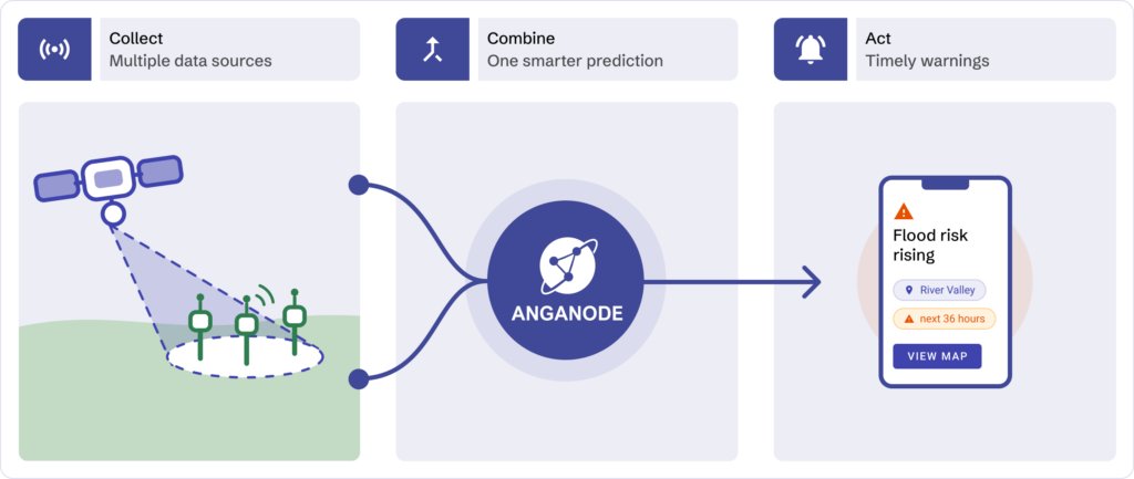
Anganode closes that gap. It combines satellite imagery with data from ground-based sensors to give a single, reliable picture of what is happening in a given place and uses each source to check the other.
The activity focuses on three areas, combining ground sensors and satellite data to make the difference: using water more efficiently, measuring carbon more confidently and forecasting flood risk.
The platform is built for people who are not remote-sensing specialists. Through a simple point-and-click interface, an application programming interface (API) or a developer kit, teams set up their own monitoring without writing code or hiring Earth observation experts. The result is faster answers at a lower cost. Anganode speeds up environmental insights by up to 70% and cuts reporting costs by 50% to 80% compared with traditional consultancy work. It also supports carbon and environmental reporting, so organisations act earlier on risks such as drought, flooding, wildfire and land instability.
Anganode serves organisations across Europe and North America that need to monitor the environment at scale. Most face the same barrier: traditional satellite analysis needs Earth observation specialists to interpret raw imagery, which leaves teams with fragmented data, slow delivery and blind spots. Anganode focuses on three areas, where combining ground sensors and satellite data makes the biggest difference.
The same fusion approach extends to further use cases. For example, it supports monitoring wildfire risk, ground movement and vegetation growth around critical power infrastructure, helping network operators act before an outage occurs.
Environmental monitoring organisations in Ireland, Germany, the Netherlands, France, Belgium and the United States.
Anganode runs on a cloud-native platform built on AWS and Kubernetes. It treats ground sensor data and satellite imagery as two independent sources, then blends them for each use case.
An orchestration layer underpins all of this. It is designed for flexibility, hiding the specialist image processing so non-experts can still make a decision backed by data. In principle, it can support any use case. The activity begins with irrigation efficiency, carbon measurement and flood risk.
Most alternatives fall into one of two fields. Some hand over raw satellite imagery that still needs in-house experts to interpret. Others lock you into fixed, single-purpose hardware. Rivals in data fusion tend to build one-off, consultancy-led setups for a single use case, which are hard to adopt and harder to scale. Anganode takes a different approach.
The activity began on 16 July 2026 and is in its early stages.



 email
email  Facebook
  Twitter
  Linkedin
  Whatsapp
  Copy link