
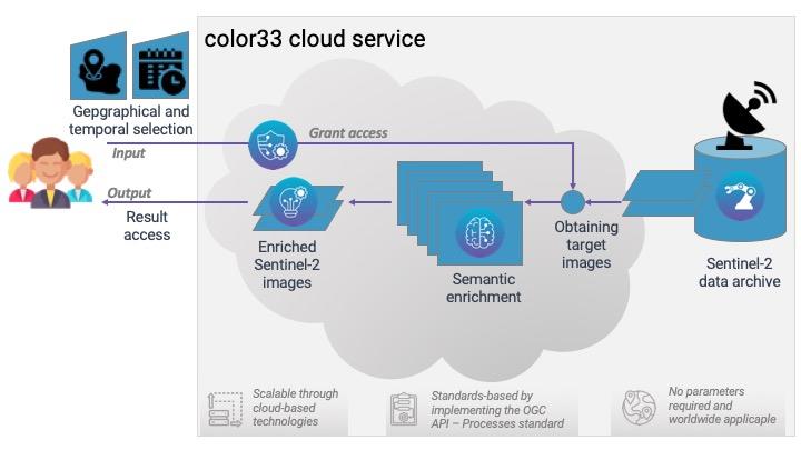
The Copernicus Programme and its Sentinel satellites generate more open and freely available satellite data than any other space programme ever before, but the key challenges are the same: converting big Earth observation data into information using transferable and automated methods that can also be used by non EO-experts. The Satellite Image Automatic Mapper (SIAM) software is an existing expert system that performs fully automatic, near real-time, preliminary classification. It categorises multispectral EO images using a physical model and produces semi-concepts (i.e. preclasses) at several levels of detail. SIAM has linear algorithmic complexity and is scalable to allow for processing big data volumes. Unlike unsupervised clustering routines or machine learning/deep learning approaches, the service produces stable, comparable, application-independent spectral categories with known semantic associations using a physical-model from EO imagery without the need for any sample data. We bring SIAMas- a-Service (SIAMaaS) into a scalable container-based infrastructure in the cloud where the data are located (e.g. DIAS), therefore making it accessible for everyone, not just EO experts. Users select images on an area-of-interest and timeframe, and SIAMaaS converts the data into information. Our approach takes care of the entire processing chain, i.e. data preparation, analysis and access to results. It will flexibly enable further online processing of results, thus establishing SIAMaaS as an anchor point for big EO data analysis, enhancing user’s workflows.
The key customers segments targeted by our service are: (1) Public entities/authorities; (2) Scientists/research organisations in general, especially non-EO experts; and (3), Support/improve existing and future (Copernicus-related) services in a b2b business model to support geospatial services of private companies (incl. Copernicus service providers) and midstream providers, like ARD providers. User’s needs:
Worldwide, but initially identified users are located in Europe.
The Satellite Image Automatic Mapper (SIAM) software is an existing expert system (prior-knowledge-based decision tree) that performs fully automatic, near real-time, preliminary classification. The software produces semantic enrichment that contains different granularities (i.e. different number of spectral categories), as well as additional data-derived information layers (e.g., multi-spectral greenness index, brightness).
Innovation: We developed SIAM-as-a-Service (SIAMaaS) into a scalable containerbased infrastructure in the cloud (e.g. DIAS) making it accessible for everyone, not just EO experts. Users select single or multiple images based on an area-of-interest and timeframe, and SIAMaaS converts the data into information. Our approach takes care of the entire processing chain, i.e. data preparation, analysis and access to results. Itwill flexibly enable further online processing of results, thus establishing SIAMaaS asan anchor point for big EO data analysis, enhancing user’s workflows.
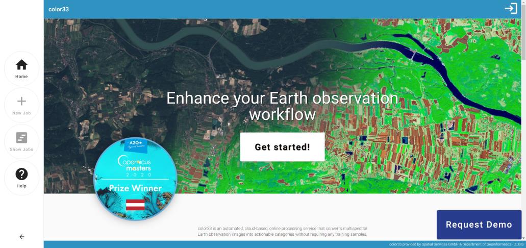
User interaction: Easy to use online web-interface and a CLI for batch processing. The web-interface is accessible under https://app.color33.io . While SIAMaaS has been developed for Sentinel-2, the 33 colors stand for the 33 spectral categories which can beautomatically derived for every calibrated multispectral-sensor allowing cross-sensor analysis beyond spectral reflectance values and number of bands. “color33” will be the name of the service when exposed to the users.
No existing service automatically classifies any user-selected Sentinel-2 data on-demand with similar depth in near real-time without user interaction, nor has a similarly proven application record. Machine-learning-based services exist, but require sample collection,
user interaction, and have not proven transferability to other geographic areas globally or to other sensors. Similar approaches are not ready for big data volumes, with respect to computation time, transferability, analyst subjectivity (e.g. samples, parametrisation) etc.
Paired with a broad / global application range these are USPs of SIAMaaS. Products built on top of SIAM are additional business opportunities and a factor for competitive sustainability. Ongoing R&D allow us to react to upcoming competitors. The original idea won the Copernicus Masters Prize Austria 2020.
The activity is closed with November 2023 and is now continuing as an operational service and expanding into the market for creating added value services on top of it and participating in relevant public tenders.


 Austria
  email
email  Facebook
  Twitter
  Linkedin
  Whatsapp
  Copy link