
 Data Processing & Visualisation
  Data Analytics, Insights & Applications
 Developing and deploying neural network-based computer vision models for geospatial data is challenging for most organisations. Typically, AI experts customise a model architecture and train it using specific datasets provided by the customer, aiming to detect predefined targets. After the model is trained, it is deployed as a “black box,” limiting the user’s ability to improve detections or add new targets without extensive re-engineering and re-training, which incurs significant time and costs. This process is not only inefficient but also poses security risks, as training data must be accessed by external engineering teams, complicating data traceability and increasing the risk of unauthorised data access and leakage. Furthermore, the lack of thorough traceability can lead to data poisoning, facilitating various attacks like adversarial attacks, label flipping, and model inversion, which can undermine the model’s integrity and potentially expose original training data.
Building on the precursor de-risk activity “SatHound: Multi-object detection solution based on artificial intelligence for non-expert EO users – eo science for society”, DVSTAI offers a new Earth Observation (EO) tool to ease the daily work of EO analysts and non AI experts, an object detection solution that end-users can configure autonomously by creating, training and deploying their own AI models to perform vision tasks over satellite imagery.
Target customers are:
DVSTAI targets niche markets of governmental and private entities operating Earth Observation satellites that require user-level analysis tools to obtain fast results on specific tasks. It is expected that such customers are owners of geospatial data and expect to use DVSTAI within their own infrastructure, potentially integrated with other processing tools in their data management process.
DVSTAI also targets to address mass markets via EO service providers, that can offer both data provisioning and analysis tools. DVSTAI can be offered bundled with existing EO services to enable their customers to create specific vision tasks over available data sets in the platform to extract additional value while keeping full flexibility of a Software as a Service model.
DVSTAI targets the customer segments described above globally.
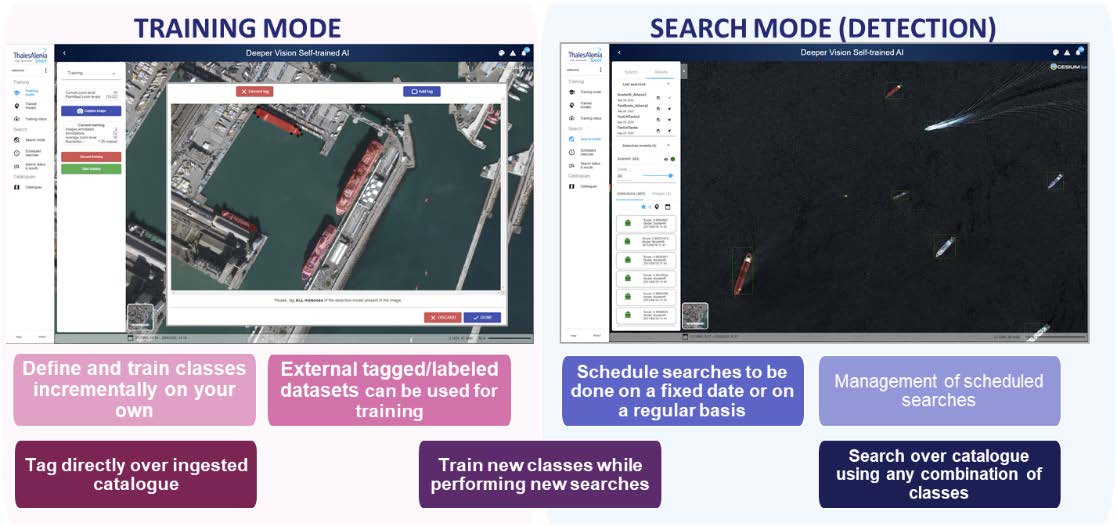
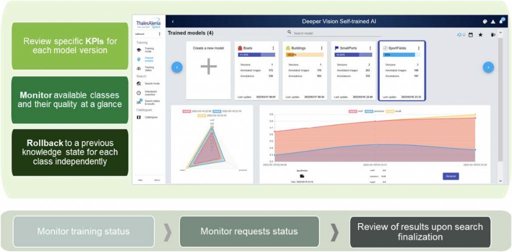
The product is designed to enable end-users to perform object detection on various types of satellite images across different spatial and temporal selections from the catalogue. It features a graphical interface that allows users to label objects of interest, train new or refine existing specialised detection models, manage trained models, administer catalogues, and conduct searches within the catalogue using one or more specific models.
The main differentiation objectives are of DVSTAI are:
The idea behind DVSTAI is to ease the daily work of EO analysts, but also to offer the general public an object detection solution that end-users can quickly set-up and use as a service to analyse public geospatial or their own data.
The solution offers an end-to-end architecture for data management, labelling, training and inference, that allows users with no or limited knowledge of AI and EO business to implement their own models on top of the platform. DVSTAI models can be tailored to fit any specific use cases where vision is involved such as object detection, change detection, semantic segmentation, etc.
DVSTAI provides added value to its customers by:
The DVSTAI InCubed project started in June 2025 and the first project milestone (MVP definition) is scheduled for September 2025.
+34 639 184 699

 email
email  Facebook
  Twitter
  Linkedin
  Whatsapp
  Copy link