 Data Analytics, Insights & Applications
  Data Processing & Visualisation
 Corporate environmental responsibility is increasingly being driven by EU legislation via requirements for water quality monitoring and reporting. This is particularly the case in areas of coastal construction and development, agriculture runoff and water treatment. Organisations such as port authorities, regulatory agencies and water agencies are responsible for maintaining and monitoring water quality in member states. TechWorks Marine provides a combination of lower-cost hardware (MiniBuoy). This hardware can be used to validate satellite water quality data in coastal and river regions, and a set of commercial services based on both the in situ and Earth observation (EO) data for water quality monitoring. This enables environmental monitoring activities on a large scale.
The customers targeted for CoastEO are environmental regulators, port authorities, construction and engineering companies, water companies and local authorities responsible for water quality. The market drivers are regulatory compliance and the development of smart cities and smart ports through the use of sensors, Internet of Things (IoT) and data platforms. TechWorks Marine is promoting this integrated approach of in situ information to commercial providers, many of which are stakeholders in this activity. The main challenge is that current water quality products marketed to the public and private sectors are generated using either in situ point source sampling, or non-validated EO information from multiple satellites.
Targeted customers are based across Europe.
The product is a combination of a low-cost MiniBuoy platform and associated processing chains to provide in situ validated EO products to a broad range of coastal users. The CoastEO service is made available through TechWorks Marine’s CoastEye platform, which is the company’s proprietary data analytics platform, providing customers with access to data. It combines information from hardware deployed by TechWorks Marine and data analytics from CoastEye to provide validated information.
The CoastEO service is based on supplying the customer with a validated EO data service. For example, validated time series measurements of chlorophyll and turbidity can be made available on the CoastEye platform. Alerts can also be created for emergencies in areas such as ports and harbours where elevated levels of hydrocarbons are observed, followed by imagery determining the extent of the outflow, fully validated by in situ measurements.
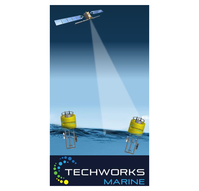
Current validation of satellite data is a very costly and onerous process primarily in the realm of high-end research activities. This product enables environmental monitoring activities on a large scale, bridging the gap between big and expensive buoy deployments for long periods, and freely available satellite data which can be difficult to process and interpret for non-experts. This is also a cost-effective approach as it reduces the need for manual onsite sampling while providing ongoing monitoring of a localised area. The in situ data can then be used to validate commercial satellite data. The CoastEye MiniBuoy has been designed in a modular architecture. This means that it is very simple to change the sensors being deployed for different applications, making it extremely versatile.

From January 2020 to December 2021, TechWorks Marine have successfully upgraded and optimised the CoastEye MiniBuoy for use in estuary and coastal environments, and the company’s CoastEye platform has been upgraded to automatically download, process, and visualise satellite-derived turbidity (NTU), total suspended matter (TSM), and chlorophyll-a (chl-a) data from both the Sentinel-2 and Sentinel-3 missions. TechWorks Marine have developed relationships with a number of potential clients in Ireland to provide EO-based services in addition to our in situ data portfolio.
