 Data Processing & Visualisation
  Data Analytics, Insights & Applications
  Ground Networks & Data Distributions
  Ground Stations & Mission Management
  Payload
  Platform
 Marble Imaging, supported by Scanway, aims to address the current need for daily Very High Resolution (VHR) Earth Observation data availability by offering a unique European solution. The instrument design, developed by Marble Imaging and Scanway, focuses on high geometrical and spectral performance, featuring two instruments: one for Visual (VIS) and Near Infrared (NIR), and another for Short Wave Infrared (SWIR). Marble Imaging will provide valuable EO data and analytics that can be seamlessly integrated into policy and decision-making processes across various sectors, including insurance, agriculture, urban planning or logistics. By aligning with the wavelengths used by Sentinel-2, the Marble-Scanway payload ensures that the data is harmonised with Copernicus products, enhancing compatibility and utility for all stakeholders. This initiative will deliver detailed, accessible, and daily EO-based analytics using VHR multispectral data from a planned constellation of up to 200 satellites.
The targeted customers for Marble Imaging’s satellite data and analysis include governmental agencies, public sector organizations and commercial customers as insurance, agriculture, or infrastructure companies. These users depend on Marble’s Very High Resolution (VHR) satellite imagery for detailed spatio-temporal analysis. In particular, the data is used to monitor aquaculture sites or forest loss, identify drivers of deforestation, and assess land use changes, which are critical for compliance with the European Deforestation Regulation (EUDR). Additionally, the data supports applications such as crop yield estimation, early drought detection through soil moisture monitoring, and maritime security, including ship tracking and oil spill detection.
The targeted customers need accurate, timely, and consistent VHR satellite data coming from a reliable European source to integrate into their analytical frameworks and operational strategies. Marble Imaging addresses these growing demands by planning to offer daily VHR imagery, which is further enhanced through machine learning-based value-added services (VAS). The “Precious Marble” analytics products extend the capabilities of this data by analysing and identifying environmental vulnerability drivers, aiding in the management and mitigation of ecological risks.
Europe and worldwide.
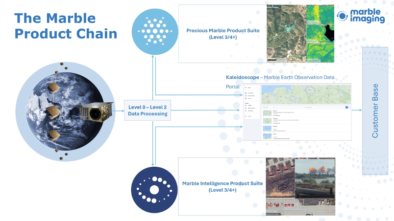
The data acquired through our satellites will be offered as Level 2 data products, Analysis Ready Data (L3 products) and value-added services (VAS) via a Marble-developed portal. With the successful deployment of the first demonstrator satellite, Marble Imaging plans to expand the Marble constellation with Scanway, as the key partner providing the VHR optical payloads. The resulting Marble data and analysis will deliver valuable insights for many customers in the EU and worldwide. This collaboration further strengthens the European EO industry.
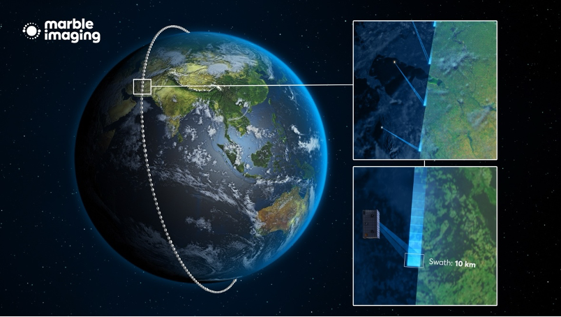
To achieve daily global coverage in VHR, the Marble Imaging-Scanway optical/multispectral payload, to be integrated into a small satellite, acquires data in the Visible, Near Infrared and Short-Wave infrared spectrum. The Level 2 data product consists of images in the Red, Green, Blue (RGB), Near-infrared (NIR) and panchromatic (PAN) bands at a ground sample distance (GSD) of 80 cm native VIS/NIR/PAN and Short-Wave infrared (SWIR) at a GSD of 6m. This is being achieved with two instruments, one for RGB, NIR, PAN and one for SWIR. The entire satellite mass of approximately 110 kg ensures compatibility with a wide range of European microlaunchers.

The Marble Constellation fills the gap regarding daily coverage of VHR data offered by a European provider. Existing satellite constellations often lack the capacity for comprehensive global mapping and timely revisit rates, leaving many critical sectors underserved.
Marble Imaging’s constellation is designed to meet the needs of sectors such as infrastructure monitoring, early hazard warning, rapid hazard mapping, forestry, and agriculture, which require consistent and temporally high-resolution satellite data. As a European provider, Marble Imaging aims to offer timely and uninterrupted access to VHR data, reducing the EU’s reliance on non-European companies. Supported by Scanway, this initiative plans to provide a reliable and independent source of satellite imagery, enhancing the ability to monitor and respond to changes on a global scale.

SEMOViS kicked off after the contract signing in July 2024. The project is currently in the early design phase, with the Requirements Review successfully completed and the Preliminary Design Review (PDR) planned to be held in February 2025. The full optical payload is planned to be delivered for integration into the satellite platform in November 2025. The first satellite launch is scheduled for the first quarter of 2026.

