


 Data Processing & Visualisation
  Data Analytics, Insights & Applications
 FieldFinder addresses the challenge of generating consistent agricultural field boundary maps across diverse geographic regions. Existing field delineation models are often trained on regionally limited datasets and show reduced performance when applied to agricultural landscapes with different field structures.
FieldFinder extends an existing field boundary detection model with additional ground-truth data from multiple global regions. This improves model generalisation and reduces geographic bias in delineation performance.
The activity integrates multi-regional training datasets and scalable processing workflows using satellite imagery, primarily from Sentinel-2. The resulting service provides globally consistent agricultural field boundary datasets. These datasets support applications including supply-chain transparency, sustainability certification, agricultural monitoring, and policy support. Customers access the product through data delivery, API integration or tailored analytics. The activity builds on previous ESA-supported developments and extends them into a globally applicable field boundary mapping solution.
Target customers include sustainability certification bodies, supply-chain transparency platforms, agricultural monitoring providers, public institutions, and climate and environmental analytics companies. These organisations require consistent agricultural field boundaries to monitor production areas, assess land-use change, and support regulatory compliance.
Existing field boundary datasets often perform well in specific regions but show reduced performance when applied to agricultural landscapes with different field structures, crop types and management practices. This limits the scalability of monitoring solutions and increases manual mapping efforts.
Customers require globally consistent field boundary datasets that perform reliably across diverse agricultural environments. FieldFinder addresses these needs by improving model generalisation through multi-regional training data and scalable processing workflows.
Customers engage through pilot projects, validation exercises, and early adoption of the generated datasets.
Worldwide, with primary focus on the EU, the UK, and Switzerland as key customer and decision-making regions. Additional target markets include major agricultural production areas in South America (especially Brazil and Colombia), Southeast Asia (Indonesia and Malaysia), South Asia (India and Vietnam), and selected African countries such as Kenya, Ghana, Uganda, and Egypt, where demand for scalable agricultural monitoring and land-use transparency is growing.
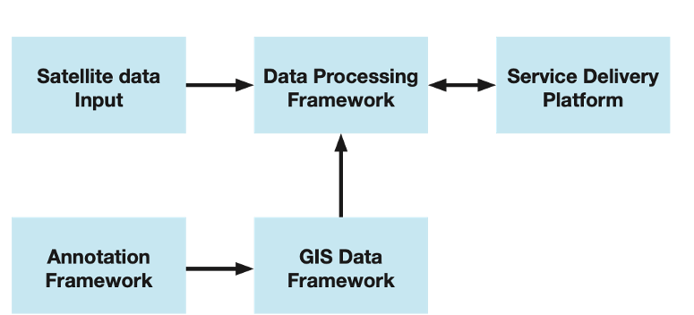
FieldFinder is a satellite-based AI service that extracts agricultural field boundaries at scale. The system processes Earth observation imagery, applies deep learning segmentation models, and generates structured field boundary datasets.
The product architecture includes:
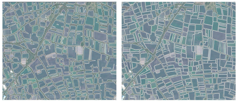
The activity focuses on improving model generalisation by integrating multi-regional training datasets. This reduces geographic bias and improves performance across diverse agricultural landscapes.
Customers interact with the product through geospatial data delivery, API access, or tailored analytics depending on integration requirements.
FieldFinder improves the consistency of agricultural field boundary mapping across different geographic regions. Existing solutions often rely on regionally limited training datasets and therefore show reduced performance when applied to new agricultural environments.
By integrating multi-regional training data, FieldFinder reduces geographic bias and enables globally consistent field delineation. This supports scalable applications in sustainability monitoring, supply-chain transparency, land-use analysis, and agricultural monitoring.
The activity builds on previous ESA-supported developments and extends them into a globally applicable service. This reduces development risk and increases technical maturity.
The resulting datasets reduce manual mapping effort, improve consistency, and enable large-scale monitoring across diverse agricultural landscapes.
FieldFinder builds on an existing field boundary detection model and datasets developed in previous activities. Initial models and ground-truth datasets are available and provide a solid foundation for extension to additional geographic regions and agricultural landscapes. The activity expands multi-regional training datasets, improves model generalisation, and validates performance across selected pilot regions. Processing pipelines and system architecture are operational at prototype level and undergo iterative refinement. Customer engagement and pilot use cases support validation, performance assessment, and alignment with user requirements.



 email
email  Facebook
  Twitter
  Linkedin
  Whatsapp
  Copy link